In this guide 19 sections ▾
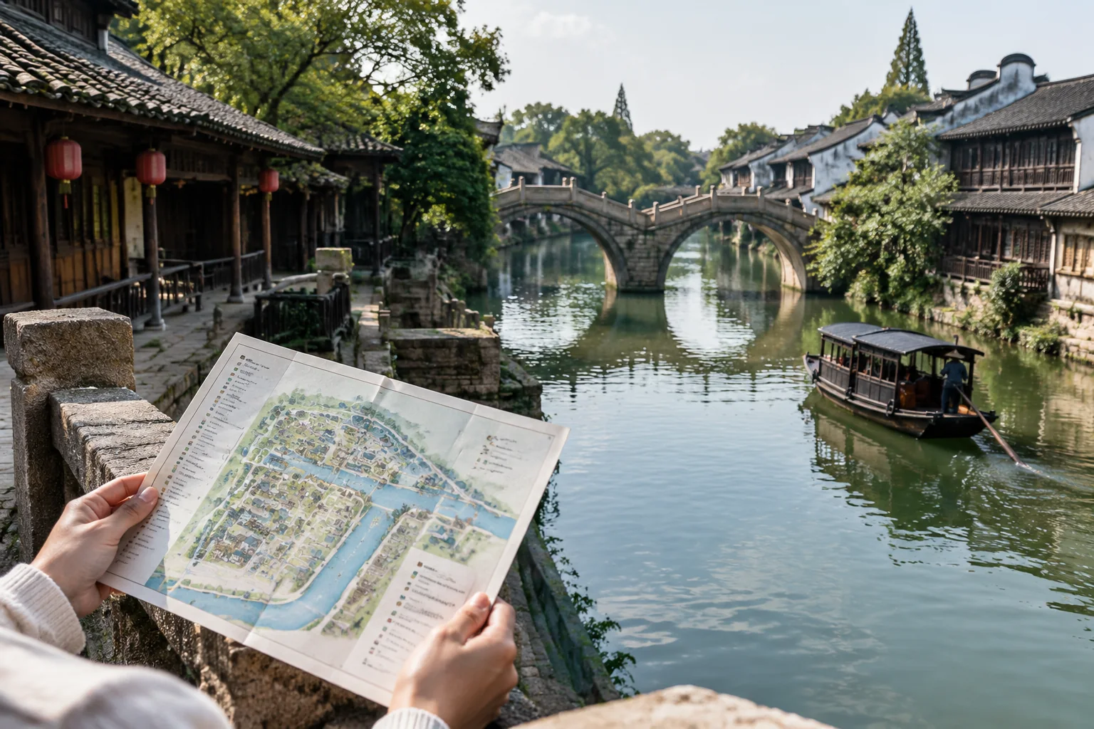
Wuzhen’s four old streets — East, West, South and North — are not four separate sights to tick off. They are the historic frame of a water town in Tongxiang, in Zhejiang’s north, and the quickest way to understand how the place is put together. Chinese travel writing traditionally describes them as four old streets crossing in a 十 shape, producing a "double chessboard" pattern in which rivers and streets run parallel and land and water sit side by side (东、西、南、北四条老街呈“十”字交叉,构成双棋盘式河街平行、水陆相邻的格局) [pdf:5:p4:c0][pdf:76:p17:c2].
That description is more useful than it first appears. One chessboard is the water; the other is the paved lane. Where the two grids meet, you get bridges. Once you can see that, the familiar "East or West?" question becomes easier, because you are choosing between two textures of the same grid rather than between two unrelated parks.
This guide is for first-time visitors who want a workable mental map, a realistic day or two, and a clear sense of what the East Scenic Area (东栅景区) and West Scenic Area (西栅景区) each reward. It is deliberately not a ticket guide: the reference material behind it is older Chinese travel writing that explains the layout well but cannot confirm today’s opening hours, entry arrangements, boat and shuttle operations, or access to the less-documented South and North old streets.
The Short Answer: Two Grids, Four Names
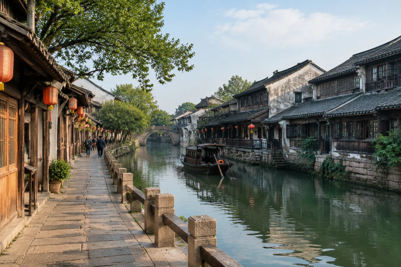
Use the four names as a compass. If you can place East, West, South and North on a map, you can keep your bearings in the older town and understand why a lane runs the way it does. Do not treat them as four equal visitor districts. The managed areas most first-timers use are the East and West scenic areas; the four old streets are the historic grid within and around which those areas sit [pdf:5:p4:c0][pdf:76:p17:c2].
The sources describe Wuzhen as a water town that preserves a late Qing and Republican-era townscape, one of the Jiangnan towns built around a working canal system rather than around a single ceremonial axis [pdf:76:p17:c2]. That has a practical consequence: there is no grand central square to anchor you. Orientation comes from water, bridges and the direction of a lane.
So plan by bank, not by street count. If you know which side of the water you are on and which bridge you last crossed, you are oriented even when the lane names still mean nothing to you.
Reading the Map: Water First, Bridges Second, Street Names Third
Stand at any junction in Wuzhen and read it in this order.
- Trace the water. Find the canal or river line through the area you plan to walk; that line gives you the direction of the parallel street. In the East Scenic Area, the sources place Guanqian Street (观前街) on the east side of the town river, with the Mao Dun Former Residence (茅盾故居) on it [pdf:5:p3:c0].
- Mark the bridges. A bridge is a rung between two banks. Cross only when you mean to change banks, or you will zigzag without gaining ground. Fengyuan Twin Bridge (逢源双桥) is described as a pair — Tongji Bridge and Renji Bridge — that you cross on the main approach into the East Scenic Area, which is a useful reminder that one "bridge" can be two crossings with a turn between them [pdf:5:p5:c0].
- Read the building line. Many waterside buildings follow a front-street, back-river form (前街后河): a shop or house fronting the lane, with water at the back. The Mao Dun Former Residence is described as a two-storey timber house opening onto the street [pdf:5:p3:c0], and the sources describe waterside restaurants in the same form [pdf:5:p11:c0]. Once you notice this, the parallel logic of the double chessboard stops being abstract.
- Treat lane names as texture. An 老街 (old street) is a long spine; a 巷 or 弄 (lane) is a narrow stitch off it. Not every sign follows the same logic, and this is a reading aid rather than a rule. If you are lost, return to the waterside and follow it to the next bridge.
A one-line version: water tells you where you are, the bridge tells you how to cross, the street name tells you what kind of corridor you are in.
East Scenic Area: Residential Lanes, Workshops and Small Museums
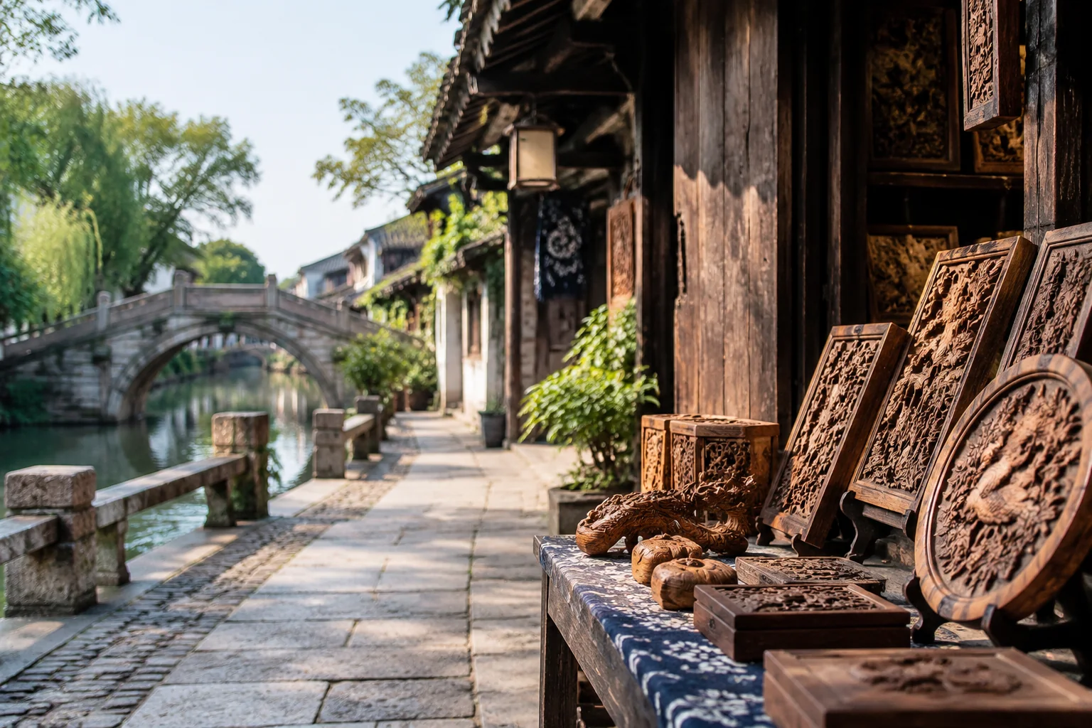
The East Scenic Area is described as the part of town that gathers the old street’s traditional residential area and its workshop area, which is why it reads as a neighbourhood with museums in it rather than a museum with shops attached [pdf:5:p4:c0]. The sources sketch a route that is useful as a pattern even if you do not follow it literally: enter past Fengyuan Twin Bridge, then work through the Jiangnan Hundred Beds Museum (江南百床馆), the Jiangnan Folk Customs Museum (江南民俗馆) and the woodcarving displays, pause for snacks, and finish with the Mao Dun Former Residence, the old stage (古戏台) and shadow puppetry [pdf:5:p5:c0][pdf:5:p3:c0].
What to notice is the workshop strip. The sources list a run of small workshops — cakes, brushes, copperware, cloth shoes, tobacco — alongside an indigo-print dye workshop, described as a continuous stretch rather than isolated stops [pdf:5:p5:c0]. That is the east side’s real character: craft rooms opening straight off a residential lane, with the life of the street continuing around them.
The sources put the East Scenic Area in the morning, with the traditional snack street at midday [pdf:5:p4:c0]. Treat that as a pattern rather than a timetable: mornings suit interiors and lanes, and you should confirm current opening hours before building a day around them.
West Scenic Area: A Wider Shop-and-Night District
The West Scenic Area lies on the west side of town beside the old Grand Canal and is described as a group of islands ringed by water, entered by ferry crossing [pdf:5:p7:c1]. Its stated focus is visitor services, shopping and leisure rather than residential sightseeing, and it is the area the sources keep for late afternoon and evening, when waterside frontages and lighting do most of the work [pdf:5:p7:c1][pdf:5:p4:c0].
Navigation here is a wider version of the same board. Use the main waterway as your spine and treat side lanes as loops that bring you back to the water. After dark, landmarks are more reliable than street names: the sources place Wuzhen Grand Theatre (乌镇大戏院) on the north side of the West Scenic Area’s old street, with a stage built over the water, and the White Lotus Pagoda (白莲塔) on the canal-side island [pdf:5:p8:c0].
The west side also spreads named sights, workshops and exhibition halls across its islands, so it rewards a looser plan: pick two or three anchors and let the water fill the gaps [pdf:5:p7:c1]. The trade-off is distance. The west side is larger and more dispersed than the east, and crossing it twice in one evening is tiring rather than efficient.
Landmarks That Keep You Oriented
A local saying quoted in the sources — "one temple, two pagodas, nine temples, thirteen nunneries" (一观二塔九寺十三庵) — is a reminder that the old town was once dense with religious buildings and that only some survive as landmarks [pdf:5:p8:c0]. Two are genuinely useful for orientation today: Xiuzhen Temple (修真观) with its attached old stage in the East Scenic Area, and the White Lotus Pagoda on the west side [pdf:5:p8:c0][pdf:5:p3:c0].
Use them as compass points rather than a to-do list. If you can see the pagoda, you know roughly where the canal is; if you are at the old stage, you are in the eastern market heart of the old town. That is enough to recover a route without staring at a phone.
Comparing the Layers: A Planning Table
The two scenic areas and the historic grid are different kinds of thing, so compare them by texture and use rather than by rank.
| Layer | What the sources describe | Best use in planning | Navigation logic | What to confirm |
|---|---|---|---|---|
| East Scenic Area (东栅景区) | The old street’s traditional residential and workshop area; museums, craft workshops, snack street, Mao Dun Former Residence, old stage | A morning of lanes, interiors and small collections | Water on one side, lanes off a spine; Fengyuan Twin Bridge as the entry anchor | Current hours, entry arrangements, which houses are open |
| West Scenic Area (西栅景区) | Islands ringed by water, entered by ferry; shops, leisure, evening lighting, theatre over water, pagoda | Late afternoon into evening; slower browsing and atmosphere | Wider waterway spine; landmarks more useful than street names after dark | Ferry operation, boat boarding points, evening access |
| South and North old streets | Part of the historic cross-shaped grid; the sources used here do not describe them as comparable visitor areas | Background orientation only | Cardinal direction, nothing more precise | Whether any part is accessible to visitors |
| Waterways and bridges | The second chessboard: parallel water and lanes, ferry crossings, water buses, twin bridges | Deciding where to cross, where to rest, where to meet | Water first, bridge second | Current boat and shuttle services |
Read the table as a set of textures, not a ranking. If your priority is interiors and lane life, the east side carries more of the day. If it is water, scale and evening atmosphere, the west side does. Trying to give both equal weight in a single afternoon is the most common way to end up remembering neither.
Sequencing a Day or Two Without Cramming
For one day, the pattern the sources suggest is East in the morning, West from late afternoon into the evening [pdf:5:p4:c0]. Build in a real buffer for the transfer. The two scenic areas have separate entrances and the sources describe a shuttle link between them [pdf:5:p14:c0], so treat the move as a journey with waiting time rather than a step through a gate. Do not schedule a museum in the east at four and a boat in the west at half past four.
For two days, give the east side a slow morning of lanes and interiors, then keep the second afternoon and evening for the west side, ideally sleeping near the gate you plan to use. If you have only half a day, pick one area and accept the trade-off: the east for craft workshops, residential lanes and small museums; the west for water, wider views and evening light.
Within the west side, the sources describe both a ferry crossing and water-bus style hops along the waterways [pdf:5:p7:c1][pdf:5:p14:c0]. That is useful when legs are tired or weather turns, but services and boarding points change — check what is running on the day rather than relying on an old itinerary.
Practical Constraints: Weather, Mobility, Families and Short Stays
A few differences are worth planning around, within what the sources can honestly support.
Wet weather. The town is read from stone-paved waterside lanes and from boats. Rain changes both your footing and the appeal of a crossing, and the sources give no covered-route alternatives. Keep one indoor anchor per half-day — a museum or exhibition hall — so a wet hour does not derail the day.
Limited mobility. The sources describe bridges, ferry boarding and timber houses with thresholds, but they do not provide step-free route information for either scenic area. Ask the operator directly about boarding assistance and about which entrances avoid stairs; do not assume a waterside path is level throughout.
Families. The east side’s compact workshop strip, shadow puppetry and short museum rooms suit children because stops are brief and close together. The west side’s distances are longer, so plan a fixed meeting bridge and let older children loop back to it.
Short stays. With one night or less, choose a single area. The double-chessboard model still helps you move confidently inside it, but it is not a reason to attempt both.
Common Planning Mistakes and a Pre-Trip Checklist
Five mistakes account for most muddled Wuzhen days:
- Treating the four old streets as four ticketed sights. They are a historic frame, not a queue of attractions.
- Booking East and West back-to-back with no transfer buffer. The gates are separate; the move takes time.
- Navigating by shop or restaurant names. Businesses change; water and bridges do not.
- Crossing every bridge. Each crossing costs you the bank you were making progress along.
- Assuming older practical details still hold. Prices, hours and boat schedules in old guides are not current facts.
Before you go, confirm: current opening hours and entry arrangements for each scenic area; whether the west-side ferry is running and where it boards; whether the inter-area shuttle is operating and from where; which boats are available and where they stop; the day’s weather; and any mobility requirements you need the operator to accommodate. Then write down one bridge per area as a meeting point, download an offline map, and keep the plan loose enough that a closed museum is an inconvenience rather than a disaster.
Frequently Asked Questions
Do I need to see all four old streets?
No. East, West, South and North describe the historic cross-shaped grid of the old town, not four equivalent visitor areas. Most first-time visits revolve around the East and West scenic areas, and the four street names are most valuable as a compass. Trying to "collect" all four in a day works against the layout rather than with it.
Should I visit the East or West Scenic Area first?
If you are doing both in one day, the sources’ pattern is East in the morning and West from late afternoon into the evening [pdf:5:p4:c0]. The east side suits lanes, workshops and interiors; the west side suits water, wider views and evening atmosphere. If you only have half a day, choose the texture you actually want rather than trying to sample both.
Is the double-chessboard idea actually useful on the ground?
Yes, as a reading method. One grid is water, one is paved lane, and bridges connect them. In practice: find the water, note your last bridge, then interpret the lane name. That sequence recovers your position faster than trying to memorise street names in advance, especially after dark on the west side.
Can I walk from the East Scenic Area to the West Scenic Area?
The sources describe the two areas as separate, with a shuttle link between them rather than a continuous stroll [pdf:5:p14:c0]. Treat the change as a transfer: allow waiting time, confirm the current pick-up point, and avoid scheduling timed entries close together on either side of the move.
Are the South and North old streets open to visitors?
The sources used here place them within the historic grid but do not describe them as visitor areas with the same facilities or ticketing as the east and west sides. Check locally before planning time there, and do not assume they function like the main scenic areas.
How long do I need in Wuzhen?
One full day lets you see one area properly, or both in a rushed way. Two days lets you give the east side a slow morning and the west side an afternoon and evening, which is the shape the sources suggest [pdf:5:p4:c0]. Anything shorter is best treated as a single-area visit.
If you would like help turning this layout into a realistic plan for your dates, group and walking pace, describe them in the inquiry form at the end of this page.
Sources and Verification
Background for this guide comes from two internal reference documents: 乌镇攻略 (Wuzhen guide), pages 2–14, and 浙江攻略 (Zhejiang guide), pages 16–18. These are internal reference PDFs held for editorial use, not public web pages, and no public link is offered here.
The layout description of the four old streets and the double-chessboard pattern of parallel rivers and streets appears on page 4 of 乌镇攻略 and page 17 of 浙江攻略. East Scenic Area routes, houses and workshops draw on pages 3, 5 and 11 of 乌镇攻略. West Scenic Area character, the theatre and the White Lotus Pagoda draw on pages 7 and 8. The shuttle and water-bus context comes from page 14.
Source-backed background in this article: the cross-shaped four-street frame, the parallel river-and-street pattern, the residential and workshop character of the east side, the island-and-ferry character and evening focus of the west side, and the landmark names used for orientation.
Not confirmed here: current opening hours, ticket and entry arrangements, ferry and shuttle operations, boat boarding points, and any access to the South and North old streets. The source documents predate the present and were not fact-checked for this guide; where they gave prices, timetables or business recommendations, those details have been left out rather than repeated as current facts.
Find places & plan your visit
These links open external search results. Confirm the exact place, entrance and current arrangements.
Need help planning your trip?
Tell us about your travel plans and send an inquiry.